Please note that gauge details are only visible to regulator users (due to data rights). You require read/write permissions in the Staging System to create, edit or delete gauge data.
Finding a spot gauge
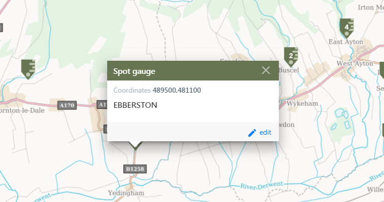
When you search for a spot gauge or select the spot gauge icon on the map, summary information is provided in the pin popup.
Reviewing a spot gauge
Once you've selected a spot gauge you can view the information stored for that site. The spot gauge window contains the 'spot gauge details' and 'gauging station analogues' tabs.
Spot gauge details
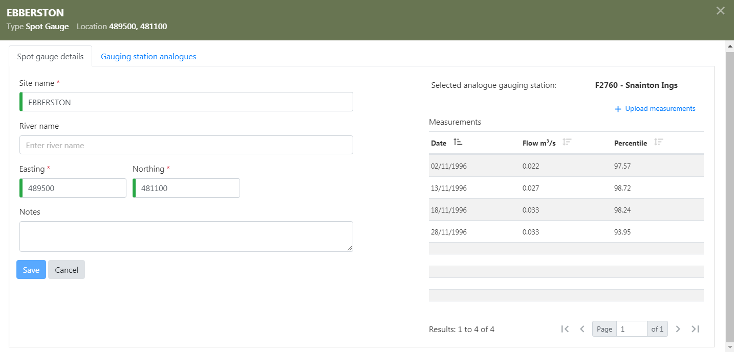
You can upload spot gauge measures of date and flow. Sample import files are available to download here: WISKI xml sample or NRFA csv sample.
The percentile will be assigned to those measurements from a gauging station once one has been selected as an analogue. This spot gauge will then be available to plot over the FDC estimate for a nearby ungauged site.
Gauging station analogues
A list of potential analogue gauging stations is presented, along with their key catchment descriptors and likely correlation with the spot gauge catchment. Gauging Stations with a suitable time series loaded can be selected as suitable for use as an analogue for spot gauges. Once an analogue has been selected, the flow percentiles from the gauging station full period of record on the date on the spot gauge measurements will be assigned to each spot gauge measurement. This lookup is conducted on the fly so that updates to the analogue gauging station time series will be translated to the spot gauge.
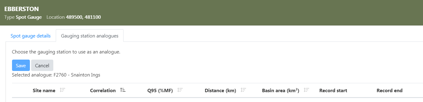
How are potential analogues chosen?
Gauging stations within 50km in the hydrometric area are listed, and presented with their Spearman Rank Correlation, Q95 (%MF), distance, area and observed record length.
The Spearman Rank Correlation is a similarity measure between a spot gauge and a gauging station. It is based upon the modelled runoff and natural Q95 flow estimates (excluding the local data algorithm) for the gauging station and spot gauge catchments and distance between the two sites.